

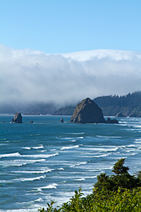
Our plan after work was to shoot at Hug Point. It's only about 10 miles south of Cannon Beach. A couple miles south of Cannon Beach,
we found a turnout (N 45.85709 W 123.96262) with a fantastic view of Haystack Rock and Cannon Beach framed between pines.
Some maps have it marked as Silver Point.
![]()
|
|
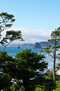
After shooting at Silver Point, we continued on to Hug Point and parked in the parking lot. As we parked, two emergency vehicles passed with their sirens blaring. An ambulance was next and stopped just beyond the parking lot. There must have been an accident just south of the park.
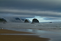
When we walked down to the beach, we discovered the tide was in and there was no way we could walk around the point. The light wasn't good and nothing was going on. We walked back to the car and saw that Highway 101 was blocked, and cars were stopped at the parking lot driveway. The was no way we were going south on Highway 101, so we turned north and headed back to Cannon Beach. Cars were lined up for a couple of miles by this time.
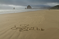
We decided to check out Tolovana Beach as our Plan B.
Tolovana Beach![]() provides
a southern access to the Haystack Rock area. We walked all the way down to Haystack Rock and The Needles.
The better view was south toward Hug Point where the fog was rolling over the ridges.
provides
a southern access to the Haystack Rock area. We walked all the way down to Haystack Rock and The Needles.
The better view was south toward Hug Point where the fog was rolling over the ridges.
|
|
| Tolovana Beach Toward Hug Point | Cannon Beach |