

We got up early this morning, ate a good breakfast, and drove back up to the slickrock area to hike Petroglyph Canyon. We call it that because of the petroglyphs hidden on the canyon wall just before you have to climb up to the upper bench.
We parked beside the road where we had parked several times during the week to photograph bighorn sheep. This seems to be one of their favorite areas. We hiked down to the curve in the road and dropped down into the wash. It's a very easy walk until you reach the end of this bottom canyon. Then, you have to climb up the slickrock to an upper bench. I managed to take us up the hard route to the bench. Since we were there last time, hikers have created a "trail" that switchbacks in the soft sand and bypasses the steep slickrock. Unfortunately, I saw it from the top, and we took a much more difficult bypass.
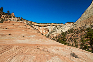
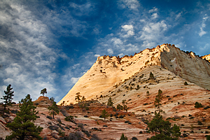
Petroglyph Canyon![]() has spectacular views up the canyon and crossbedding patterns across the faces of entire mesas
and canyon walls. Last time we were in this canyon, we discovered two bighorn sheep on the ridge above us when
we heard their hooves scraping on the sandstone. That's when we learned the lesson of always carrying your long lens
on a hike; even when you're not expecting to see bighorn.
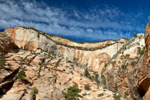
has spectacular views up the canyon and crossbedding patterns across the faces of entire mesas
and canyon walls. Last time we were in this canyon, we discovered two bighorn sheep on the ridge above us when
we heard their hooves scraping on the sandstone. That's when we learned the lesson of always carrying your long lens
on a hike; even when you're not expecting to see bighorn.
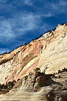
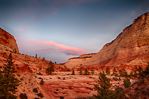
We were looking for different angles to shoot reflections in one of the remaining pools after the storm when I looked up to see a bighorn ram high on the same ridge where we had seen the bighorn last time. Even though I had my 400 telephoto lens, it crossed the saddle before I could even get off a shot. We continued hiking about 3/4 mile up the canyon, but were disappointed that nearly all the reflecting pools were already dry. If it rains on Monday as forecast, we'll return to Petroglyph Canyon on Tuesday for our last day of shooting in Zion.
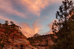
As we began hiking out of the canyon, we noticed our drab blue sky was turning into a canvas of interesting cirrus clouds. They seemed to be streaming in from west to east and getting better all the time. We had to decide where we could shoot sunset and take advantage of these clouds.
 |
|
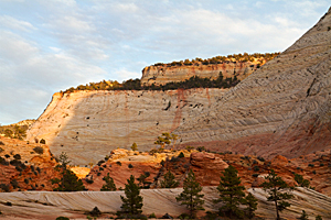
We drove up the road and parked where I used to photograph my favorite sunset tree![]() . The tree is nearly gone now;
sheared off about 2 feet above its sandstone perch. But the view east across the sandstone ridges still promised
to be a good sunset location. We ate our lunch and kept an eye on the sky. Two photographers pulled up
in their BMW and got all their equipment ready. They started walking along the road and then cut across the ridge
so they could shoot the sandstone formation where "my tree" grew. They were now going to be in every one of our images.
. The tree is nearly gone now;
sheared off about 2 feet above its sandstone perch. But the view east across the sandstone ridges still promised
to be a good sunset location. We ate our lunch and kept an eye on the sky. Two photographers pulled up
in their BMW and got all their equipment ready. They started walking along the road and then cut across the ridge
so they could shoot the sandstone formation where "my tree" grew. They were now going to be in every one of our images.
As sunset neared, the light just kept getting better and better. The huge arch on the canyon wall to our left glowed a deeper and richer gold, and the shadows of the trees and ridges in front of us grew bolder and more dramatic. The clouds looked like tiny puff balls in some areas of the sky and cotton candy in others. It was the best sunset of the entire trip, but the real surprise came after sunset. Pinks and yellows started to stretch across the sky; especially to our right over a mini-Mt. Fuji. The color wasn't spectacular, but it put the finishing touches on a good sunset.
|
|
|
|
We got back to camp late and settled for burritos for dinner. They were quick, easy, and warm; a very good combination. Then we celebrated our successful day of shooting with two movies.