

Capitol Reef
Today was a moving day. Originally, we had planned to go to Moab and then Goblin State Park after Blanding. We decided to skip Moab and Goblin and take a short cut to Capitol Reef National Park. We heard more horror stories about how crowded Arches National Park was from campers at Bisti. Arches used to be one of our favorite parks before it became so popular. The people we talked to said they closed some parking areas at 8:00 a.m. because they were already full. When we realized we could cut across over Lake Powell to Capitol Reef, we changed our plans to get us closer to our original schedule.
Capitol Reef has the best campground in the National Park system. It used to be a well-kept secret in the 70's and 80's, but the secret is out. We got up at 6:00 this morning and were on the road by 7:00. We had never driven Highway 95 across Cedar Mesa and down into the canyons near Lake Powell. We crossed the Colorado River near Hite along a beautiful stretch of highway. As we continued north toward Hanksville, we peered down into deep canyons that meandered along the road. The canyons had sandstone walls that had to be over 100 feet high and flat-bottomed washes dotted with golden cottonwoods.
After we made the turn on Highway 24 toward Capitol Reef, an adult red fox crossed the road. It was one of those times I wished we were driving the Explorer so we could make a quick stop to photograph. With the motorhome, we had to settle for slowing down to get a better look. We had been commenting on how smooth the highway was and how good most of the highways had been since we left Arizona. Coming around a corner, we discovered why the road was so smooth. The road crew had blocked off one lane and was re-surfacing the road.
We got to Capitol Reef about 10:15 and drove straight to the campground. We got one of the best sites in the campground in Loop B. We're camped under a massive cottonwood tree in a site wide enough for 3 vehicles. We're only a short distance from the Fremont River and look out on the red sandstone walls of the main canyon.
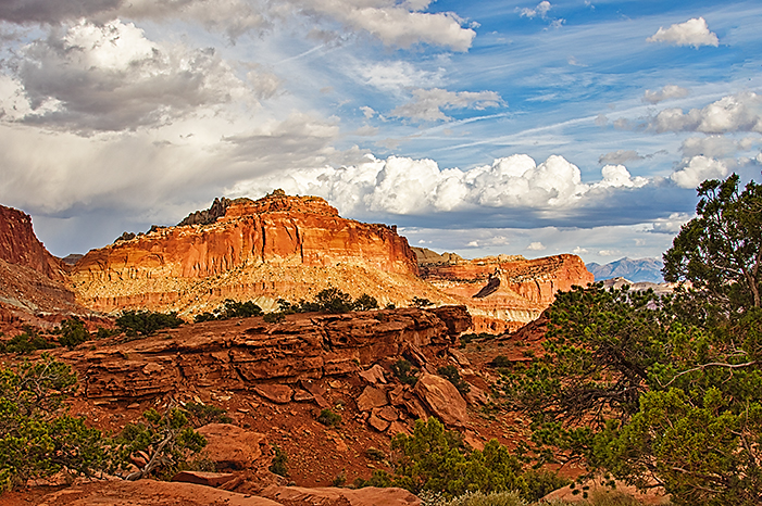
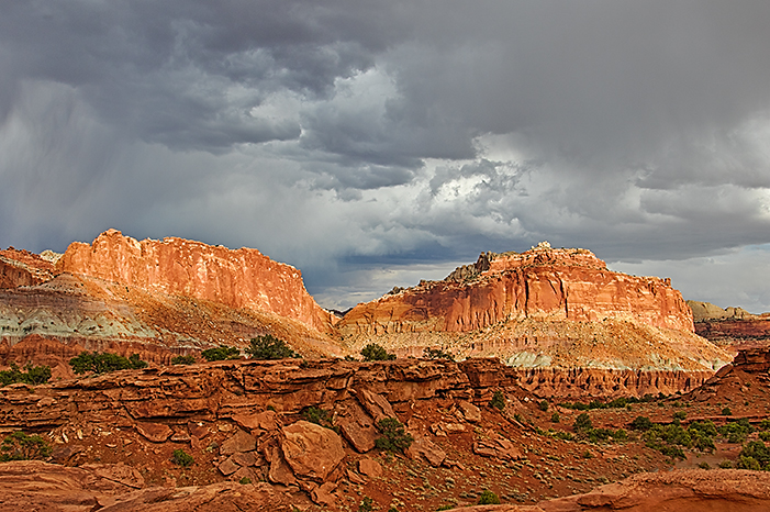
As we were sitting at the table in the late afternoon, we heard a peel of thunder behind us. A dark and threatening cloud filled the sky to the south, but the sun was breaking through the clouds in the west. It looked like we might have a good sunset, so we packed up our gear and drove up to Panorama Point. Every time the sun broke through the clouds, warm light spotlighted the features along the canyon walls. The threatening clouds added to the drama.
 |
 |
 |
 |
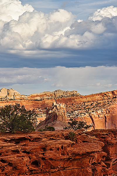
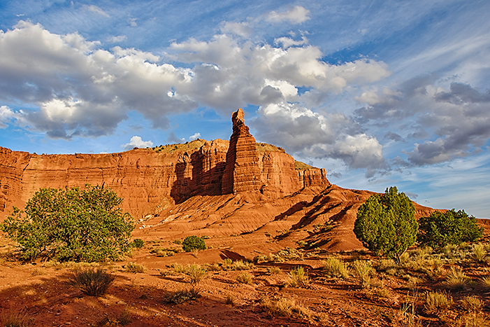
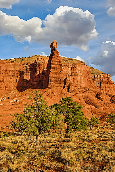
When the clouds covered the sun, we moved to Chimney Rock to await the sun's next escape. By the time we had our tripods out and our gear organized, Chimney Rock was lit. The Chimney Rock area is very cool with its foreground of pinyon pines and junipers. Ripple-marked slabs of sandstone throughout the area reveal the story of the rock's formation in a shallow sea.
 |
 |
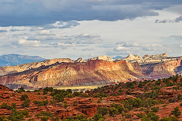
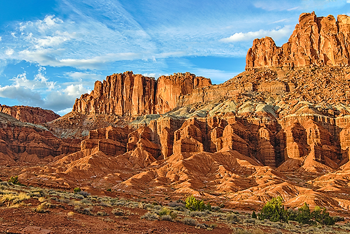
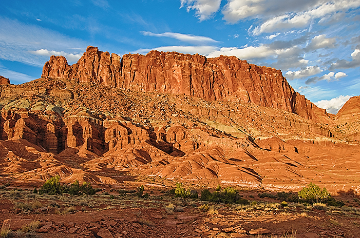
Our final stop was the Fluted Wall (Some maps call this area the Mummy Cliffs). The warm sunset light deepened the shadows of the curtain's pleats and emphasized the 3-D quality of the canyon wall.
 |
 |
Tonight was the first night of the trip where we didn't have electrical hookups. In fact, we have no hookups here. That meant a whole change of mindset. Now, we have to limit our electrical and water use. That beautiful cottonwood tree that watches over our campsite also dramatically cuts the amount of solar energy we can produce. Now, we have to run our generator to re-charge our batteries.