

Burr Trail
Today, we drove the Burr Trail loop from Capitol Reef to the Notom-Bullfrog Road, up the switchbacks of the Burr Trail, across a plateau, through colorful Long Canyon, past the petrified sand dunes near Boulder, over Boulder Mountain, and back to Capitol Reef. This is always an amazing drive because you parallel the Waterpocket Fold for the first 20 miles and then climb up over the fold where it looks like no road could possibly be built. John Burr built the original trail to move his cattle from the plateaus in the fall to the lower pastures east of the fold. In the spring, he reversed the cattle drive. How he found or built the original trail is beyond me.
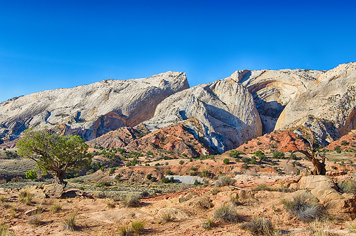
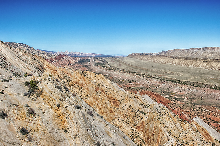
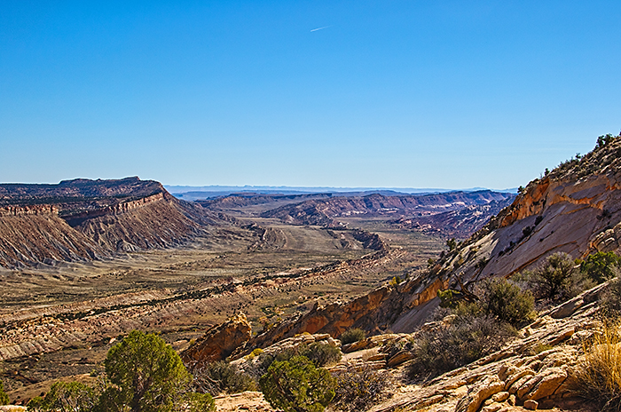
We left Capitol Reef on Highway 24, but turned south on the Notom Road after only 10 miles. The next 20 miles of mostly gravel road paralleled the Waterpocket Fold as we drove "inside" the remnants of an eroded monocline. Ridges on both sides of the road showed where the folded layers had been "sliced off" by erosion. To the east, rose the Henry Mountains, the last major mountain range in the lower 48 states to be mapped. The highest peaks of the volcanic Henry Mountains rise 6,000 feet above the surrounding valleys.
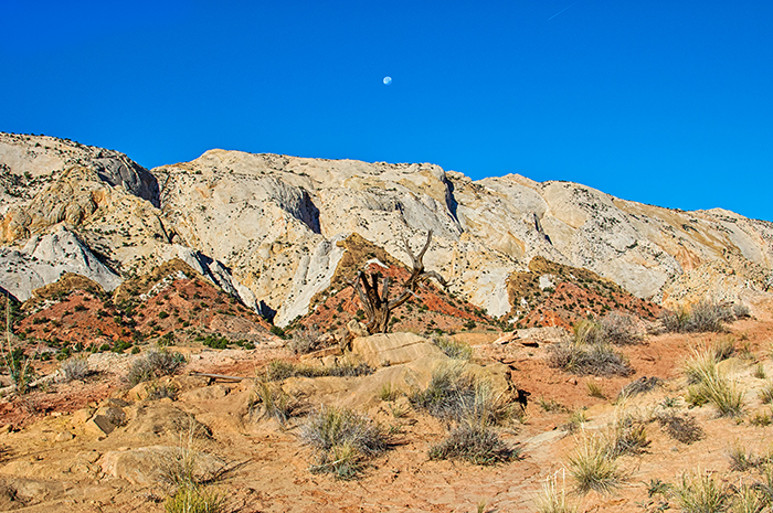
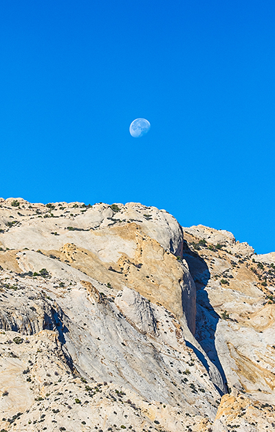
My favorite stop along the Waterpocket Fold is at 37.868598° -111.009780°. Remnants of a sandstone layer have been uplifted so they are standing nearly on-end. The pinyon pines and junipers create an interesting foreground. But it's the views of the Waterpocket Fold that makes this stop special. If you walk a few yards to the east, a ridge provides a jaw-dropping view up and down the Waterpocket Fold that must include at least 40 miles. The moon setting over the ridge this morning was an extra bonus.
 |
 |
 |
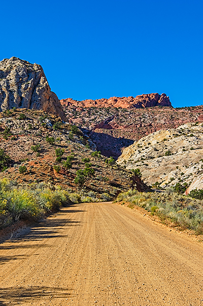
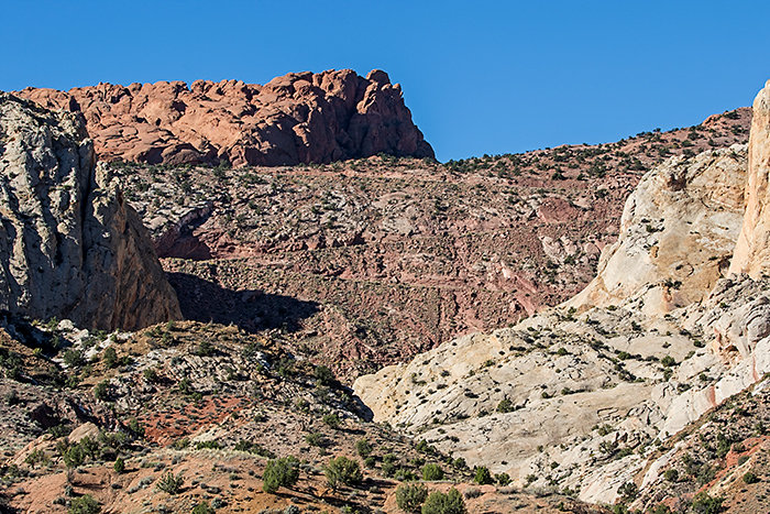
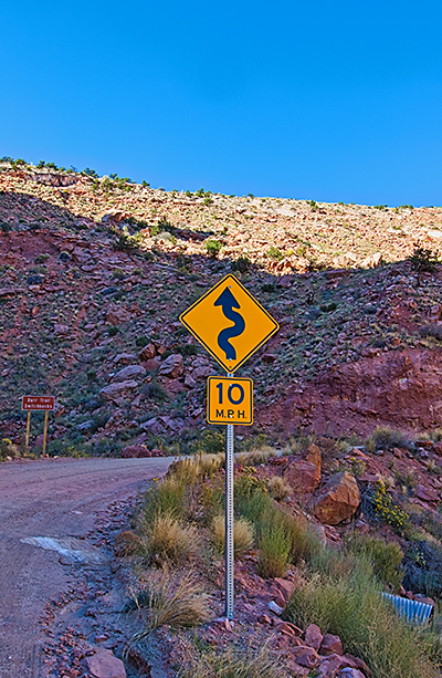
When I finally pulled myself away, we were ready for the final few miles before climbing the Burr Trail switchbacks. We've driven the switchbacks at least six times, but we're always completely amazed that there's a road that climbs over the fold. From a distance, there doesn't seem to be any possibility of a road climbing the fold (as you can see from the images below). As we started the climb, a road sign warned us of the curvy road and 10 MPH speed limit. I'm not sure any speed limit is needed with the sharp switchbacks. The road was very well maintained and relatively smooth this year, but it was still slow going. Besides, the views back down to the valley below were stunning.
 |
 |
 |
Once on the top of the plateau, we drove to Muley Twist Canyon to hike to the Strike Valley Overlook![]() . This was definitely a 4x4 road this year. Last time here,
we parked in a lot and hiked down the road to check it out. There was one major drop and rocky area that scared us off, so we hiked the 2 1/2 miles
to Strike Valley Overlook. Today, we paused at the outer-most parking area and let a Nissan 4x4 pass us. We continued down the road to a second parking area
when he suddenly came back up the road toward us. We parked and figured we'd better walk the road a bit if it had scared off the Nissan driver. He had only driven
a few hundred feet past the parking area before he turned around. We decided we could get past the first drop, but when we got to the next corner,
we knew we were in for a hike. We simply didn't have the clearance to get past the boulders that now stretched across the wash. This area had some significant
flash flooding over the summer, and we were definitely seeing the results of the flooding here.
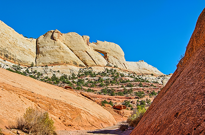
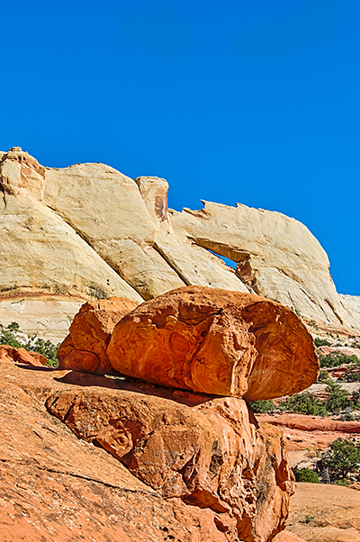
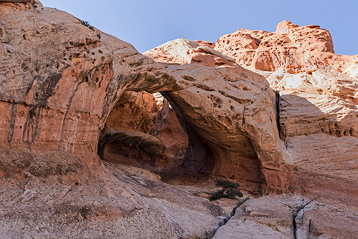
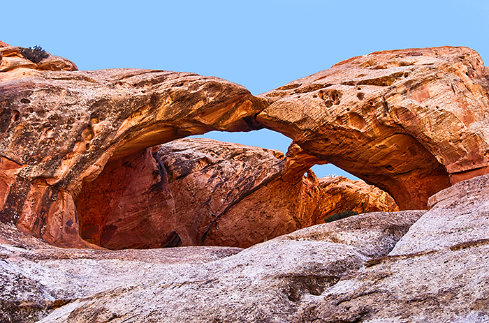
We walked back to the Explorer, grabbed our gear, and started hiking. It's an easy hike up the canyon toward Strike Valley Overlook with 3 arches
to make it interesting. Still...we had hoped we'd only have to hike 0.6 miles round trip to the overlook because we could drive all the way
to the trailhead. Instead today's hike was 6.22 miles.
. This was definitely a 4x4 road this year. Last time here,
we parked in a lot and hiked down the road to check it out. There was one major drop and rocky area that scared us off, so we hiked the 2 1/2 miles
to Strike Valley Overlook. Today, we paused at the outer-most parking area and let a Nissan 4x4 pass us. We continued down the road to a second parking area
when he suddenly came back up the road toward us. We parked and figured we'd better walk the road a bit if it had scared off the Nissan driver. He had only driven
a few hundred feet past the parking area before he turned around. We decided we could get past the first drop, but when we got to the next corner,
we knew we were in for a hike. We simply didn't have the clearance to get past the boulders that now stretched across the wash. This area had some significant
flash flooding over the summer, and we were definitely seeing the results of the flooding here.
We walked back to the Explorer, grabbed our gear, and started hiking. It's an easy hike up the canyon toward Strike Valley Overlook with 3 arches
to make it interesting. Still...we had hoped we'd only have to hike 0.6 miles round trip to the overlook because we could drive all the way
to the trailhead. Instead today's hike was 6.22 miles.
 |
 |
| Peek-a-boo Arch | Peek-a-boo Arch |
Strike Valley Overlook is on top of the Waterpocket Fold and provided a birds-eye view across Strike Valley to the Henry Mountains. Looking north, we saw the Waterpocket Fold almost all the way to Highway 24. Looking south, the fold seemed to go on forever as it approached Lake Powell. Unfortunately, it was now midday and without any clouds, the photos were disappointing. I've always wanted to shoot sunrise or the Milky Way from Strike Valley Overlook, but the rough road and required hiking have pretty much eliminated that possibility.
 |
 |
| Waterpocket Fold Looking North | Waterpocket Fold Looking South |
On the hike back to the Explorer, we photographed the two northern arches high on the canyon walls. From the middle of the wash, they weren't that impressive. But when we hiked to the base of the canyon wall, we could look through the arches and discovered they were both double arches. Trinity Double Arch was especially impressive.
 |
 |
| Unnamed Double Arch | Trinity Double Arch |
When we got back to the Explorer, we ate lunch and continued across the plateau toward Boulder. The plateau was covered by pinyon pines, junipers, and open range land. As we continued toward Boulder, we climbed a small ridge and dropped into Long Valley. Although the cottonwoods were past peak, the floor of the canyon was dotted with gold. Since we did the 6-mile hike to Strike Valley Overlook, we skipped the Long Canyon slot canyon hike. We'll have to do it next time.
Just before Boulder, we reached the towering fossilized sand dunes of the Navajo Sandstone. They were a couple of hundred feet high and held the crossbedding record of the prevailing winds when they were formed.
We crossed over Boulder Mountain without stopping since all the aspens had lost their leaves weeks ago. Our final stop was the gas station near Torrey to catch up on the news, check email, and fill the Explorer with fuel for our Cathedral Valley trip on Friday.
Today was a good day.