

Edmaier's Secret
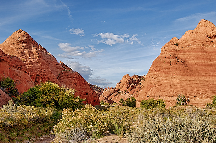
Today, was one of our best hikes of the trip. Edmaier's Secret is one of the "hot," new hikes, thanks to the Internet. It's about 40 miles east of Kanab on Highway 89 and then 5 more miles on a dirt road. It's on the same dirt road as we took to The Wave nine years ago when that was one of the "hot" hikes of the day.
Edmaier's Secret has an interesting history. In the 1950s, Bernard Edmaier, an aerial landscape photographer, photographed an unknown area and later published the images in a book. Fifty years later, a German-American ran across one of the photographs and was so fascinated that he was determined to find out its exact location. He eventually accumulated enough information to identify the area that is unofficially named Edmaier's Secret.
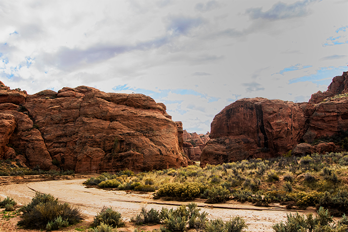
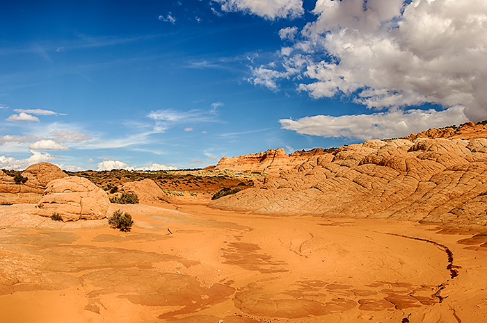
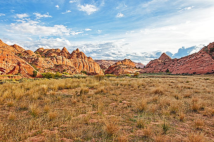
We parked at the Buckskin Gulch trailhead, paid our $12.00 to the BLM, and started hiking up the wash. When I was planning this hike in Google Earth, I was concerned because the first two miles looked pretty boring as we walked up the level wash toward Edmaier's Secret. That concern was completely unfounded. The rock formations that lined the canyon were a mixture of the formations at Valley of Fire and those just above the tunnel at Zion National Park. We were constantly stopping to photograph. There were two areas where the wash narrowed to 10 or 15 feet wide, which acted as a portal to the next section of the trail. As soon as we passed through the second "portal," the dome that marks Edmaier's Secret appeared in the distance. After another 1/2 mile, we climbed out of Buckskin Wash and slogged across the sandy ridges toward Edmaier's Secret.
 |
 |
 |
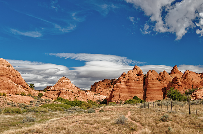
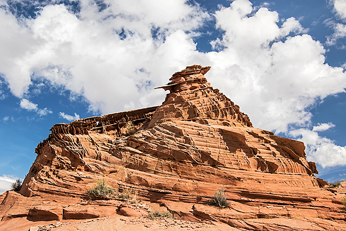
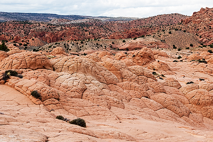
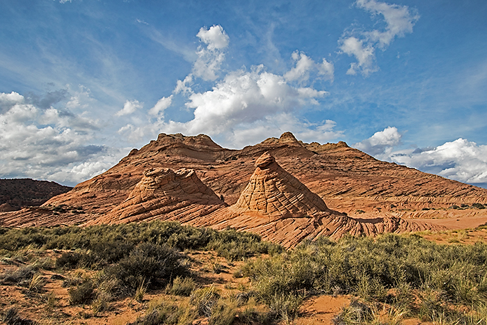
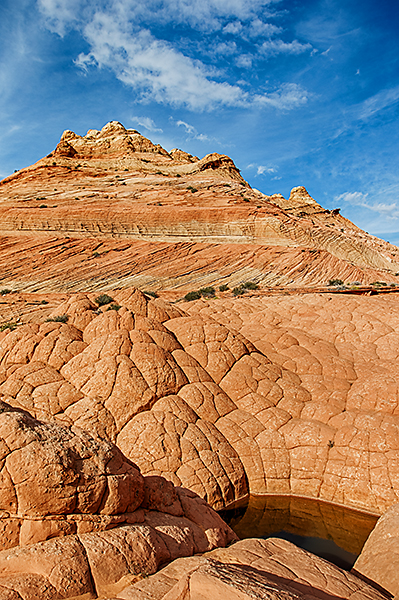
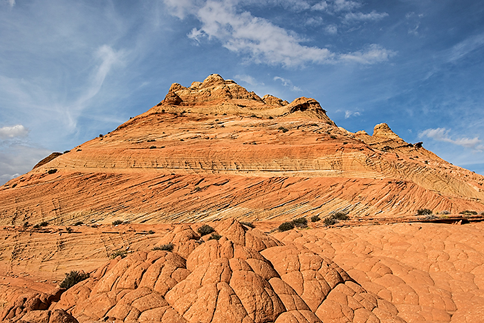
Edmaier's Secret is known for three types of formations: lace sandstone, brain rock, and tepee formations.![]() The tepee formations lined the east wall of the main canyon and rose out of the wash west of the main dome of Edmaier's
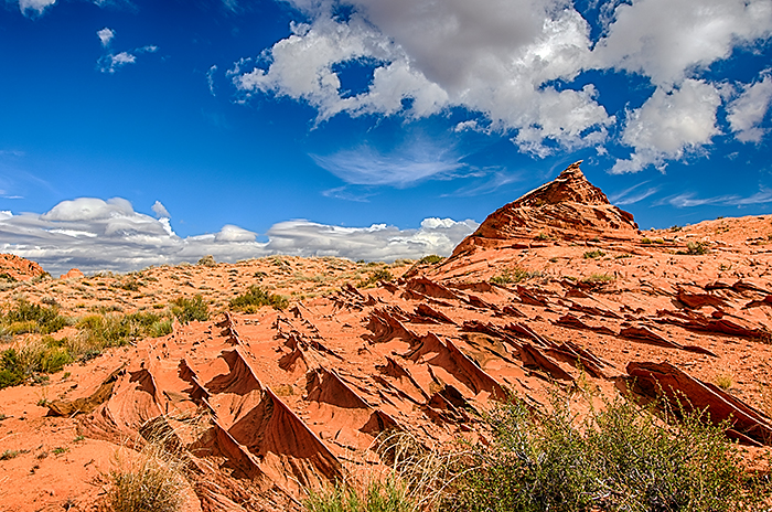
Secret. Lace Castle (my name for it) was the first area where we found the lace sandstone. As we climbed a ridge of sand, we saw
delicate ridges of sandstone cutting across the contour of the sandy hill. Very thin layers of sandstone were uplifted
at a 60-degree angle and now stuck out above the sand. Just beyond the rows of sandstone ridges was the Lace Castle. It wasn't very big,
but the intricate design of the lace sandstone was incredible. One area looked like honeycombs of sandstone. The rest was covered with
intricate patterns crisscrossing the layered sandstone. It must be amazing at sunset.
The tepee formations lined the east wall of the main canyon and rose out of the wash west of the main dome of Edmaier's
Secret. Lace Castle (my name for it) was the first area where we found the lace sandstone. As we climbed a ridge of sand, we saw
delicate ridges of sandstone cutting across the contour of the sandy hill. Very thin layers of sandstone were uplifted
at a 60-degree angle and now stuck out above the sand. Just beyond the rows of sandstone ridges was the Lace Castle. It wasn't very big,
but the intricate design of the lace sandstone was incredible. One area looked like honeycombs of sandstone. The rest was covered with
intricate patterns crisscrossing the layered sandstone. It must be amazing at sunset.
 |
 |
| Lace Castle | Lace Castle |
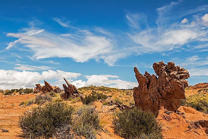
Our next goal was to find the Dragon in the Sand. Thanks to the GPS, we had little trouble finding the uplifted sandstone layer that created the serrated back of the imaginary dragon.
As we ate lunch, we watched the clouds fly across the sky. We lucked out with the weather today. When we first got up, the sky was completely overcast, and we went back to bed. An hour later, we had bright, blue skies. By the time we reached the parking area, the cumulus clouds were re-filling the sky.
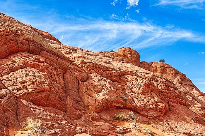
After lunch, we hiked to the bottom of wash at the base of the giant dome to shoot the "brain rocks." Once you see them, it's obvious how they were named. At the base of the dome, we saw some of the most contorted sandstone I've ever seen. It looked like someone had rung out the layers like a wash cloth.
Turning a corner in the wash, we looked up a side wash with brain rocks in the foreground and tepee formations in the background.
 |
 |
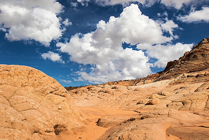
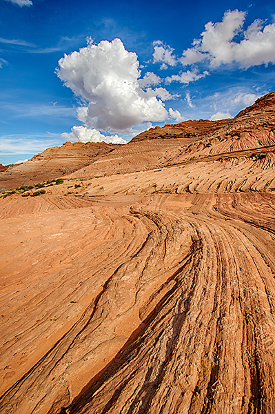
As we continued up the wash, it abruptly ended and the layers climbed steeply up toward the top of the ridge. We found a layer of sandstone that contoured up out of the bottom of the wash toward the ropes of sandstone that led up the canyon wall. We climbed to a wide layer that provided a view down into the area we had just hiked.
 |
 |
 |
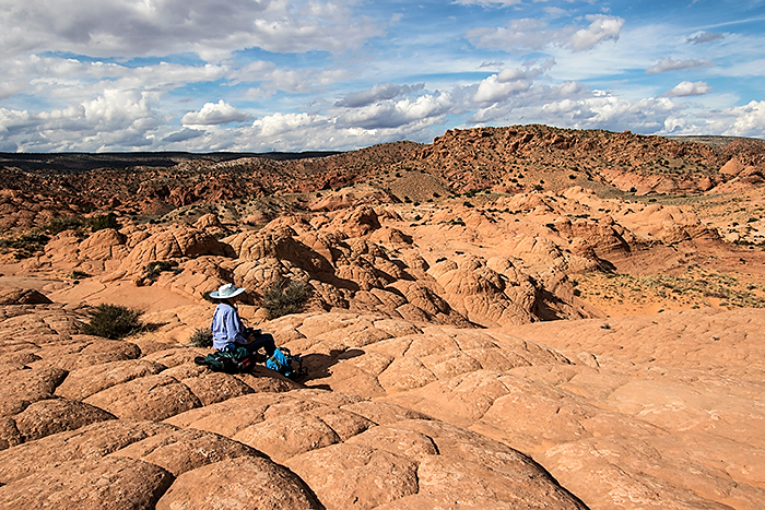
Carol decided she had climbed enough, but I wanted to see what was at the top of the ridge. I continued up the sandstone stair-steps to the top of the ridge. Incredibly, two very-large potholes were filled with water. They seemed to be completely out-of-place at the top of such a high ridge.
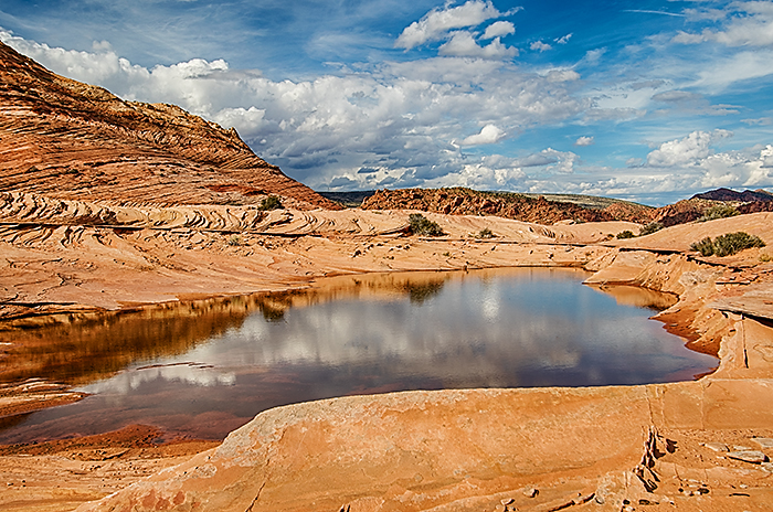
The top of the ridge was "one of the high points" of the hike. The views in all directions were gorgeous. I stood right at the base of the huge dome with its crossbedding, strange brain rocks at the summit, and lace sandstone on one wall. Interesting formations and sandstone layering were everywhere. I tried to find a way down from the summit that would allow hiking all the way around the dome. Instead, I discovered more water-filled tank trapped in the folds of more brain rock. The tanks appeared to be several feet deep, so they were likely a reliable source of water for local wildlife.
 |
 |
 |
I could have spent hours hiking along surrounding ridges, but it was 4:00 and I needed to get back to Carol. We used the GPS as we slogged across the sand hills and dropped into Buckskin Wash. We hiked through the final narrows and into the expansive meadow leading back to the parking area.
 |
 |
We returned to the main highway and were well on our way back to camp before it got dark.