

Cascade Lakes
This morning, we returned to the Cascade Lakes area where we shot sunset on Monday. I wanted to re-create shots I had seen online of Todd Lake reflecting Mt. Bachelor. I found a ridge on Google Earth on the north end of Todd Lake that looked promising and set everything up in my GPS.
The first surprise came when we reached the Road Closed sign and the "Warning Dangerous Area" tape across the road. We noticed all the tracks continued up the road, so we did the same. The road closure added a mile to our hike, but it was an easy hike to the trailhead. From the parking area, we looked out across a beautiful meadow filled with buttercups to Mt. Bachelor in the distance. The stream had overflowed the banks and flooded the meadow to create a wildflower garden. And it will get even better as the meadow begins to dry out and the succession of wildflower blooms continues over the next couple of weeks.

Todd Lake was only about 1/4 mile from the parking lot on an easy, level trail. When we reached the lake, we discovered that spring had not reached the hillsides around Todd Lake, and the hiking was slow as we continually crossed snowdrifts on the trail to the north end of the lake. Carol decided she would pass on the hike to the upper end of the lake. I wanted the shot from the ridge above the lake, so I hiked the 3/4 mile to the upper end. The meadow above the lake must have just melted over the past few days, because water was everywhere and the only green were the patches of buttercups. Instead of the lush green meadow I expected, the area was mostly brown and gray grasses from last season. Timing is everything. In another week the entire area will be rich green and filled with wildflowers. But not today...
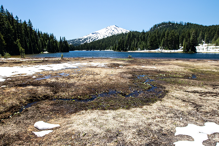
It took so long to hike to the upper end of the lake, I didn't even try to climb the ridge behind the lake for the shot I wanted. I noticed that it looked a lot steeper than it appeared in Google Earth. I hiked back down to Carol at the bottom end of the lake, and we hiked back out to the Explorer. It was lunch time, so we drove over to the viewpoint where we shot sunset on Sunday evening.
We spent the rest of the afternoon checking out the string of lakes that make up the Cascades Lake area. There was enough breeze throughout the afternoon that there was no chance of reflection images, and the scenery wasn't that unique. It looked very much like the lakes around Mammoth with Jeffrey Pines and lots of lava flows around the lakes. Each lake seems to have a small, rustic resort that cater to fishermen. Our treat for the day was ice cream at the Lava Lake Resort.
By the time we reached Crane Prairie Reservoir, the lakes started looking the same and we had seen enough. We cut across to Highway 97 on a forest road and returned to camp.
I'm glad we did the Todd Lake hike, but it was a disappointing day photographically. We eliminated areas to shoot in the future instead of adding new areas.