

When we first arrived at Banff, Friday had been forecast as the first day of sunny skies. They missed that one. The skies were still cloudy, and the valley next to the campground was filled with clouds. When we reached Bow Valley, the skies cleared so we made a run to Lake Minnewanka to see if we could get some good reflection pictures in the early light. Good idea...bad timing. Lake Minnewanka is an afternoon picture, so it was time wasted.
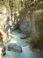
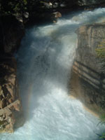
As we looked north up the Bow Valley, it looked cloudy and overcast ahead, so we set off on the Kootenay National Park, Radium Hot Springs, Golden, and Yoho National Park loop. As we climbed toward the Continental Divide in Kootenay, the skies cleared except for the very tops of the mountains. We actually had sunshine! Our only major stop in Kootenay was Marble Canyon, a slit that had been carved through the limestone of the canyon. In places it was only a few feet wide and seemed to be a hundred feet straight down. It was kind of eerie standing on the bridges spanning the chasm. At the top was the waterfall that is continuing to retreat up the valley as the limestone dissolves.
 |
 |
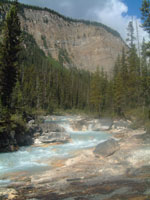 |
| Mouth of Marble Canyon | Waterfall at Head of Canyon | Tokumm Creek Above Falls |
We left Kootenay and dropped down into Radium Hot Springs in British Columbia. We drove north up the valley to the little town of Golden. The floor of the valley for the 100 km between the two towns was almost all lake or marsh. The only excitement was the black bear that crossed the road ahead of us in a very big hurry.
Immediately after leaving Golden, we found a herd of mountain goats along the road. They were quite tame, but even they had their limits. When a Japanese family continued to move closer and closer, they finally ambled off and headed down the mountain.
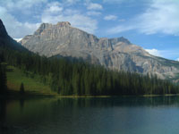
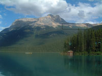
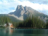
Soon after leaving Golden, we entered Yoho National Park. Although less known than Banff and Jasper, the scenery was amazing: great towering mountains surrounded the road as it wound up the valleys toward the continental divide. The two highlights of Yoho were Emerald Lake and Tokakkaw Falls. Emerald Lake was gorgeous. It was crowded, but the scenery was magnificent. The lake was calm and the sun was out, so we had some great photography opportunities. Equally amazing, was that we were looking across the lake to Mt. Burgess. Anyone who has studied geology has heard of the Burgess shale, one of the most famous locales for trilobite fossils in the world. What was truly amazing, was that they found the fossils on a ridge that now towers a couple of thousand feet above the lake, and five or six thousand feet above sea level where the trilobites had once lived.
 |
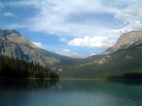 |
| Emerald Lake | Emerald Lake |
 |
 |
| Site of Burgess Shale Trilobite Quarry Shown |
Emerald Lake Lodge |
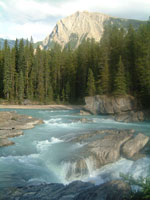
We eventually forced ourselves to leave Emerald Lake and stopped at a natural bridge on the road we had taken to Emerald Lake. It turned out to be quite an unusual formation.
 |
 |
 |
| River above Natural Bridge |
Natural Bridge | Tokakkaw Falls |
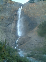
Although it was getting late, we headed off for Tokakkaw Falls. This is the third highest waterfall in North America, so we didn't want to miss it. Unfortunately, the sun had already gone down far enough that the waterfall was in shadows when we arrived.
We continued photographing the peaks around Tokakkaw Falls until all the light was gone. Cathedral Peak was especially picturesque in the last, golden light of the day.
Friday was our only full day of photographing since arriving at Banff. We returned to camp about 9:30 and could actually see stars in the sky.