Big Sur
Today was our biggest day on the California coast. Our goal was to shoot the coast as far as Big Sur and McWay Falls. That's only about 60 miles, but it is filled with gorgeous scenery. When people talk about the rugged Central California coast, they are usually talking about the Big Sur area. We certainly weren't disappointed.
Our original plan was for Wendell to join us for the day and serve as guide. He spends a lot of time along this portion of the coast since he moved to Santa Cruz. Shortly after we got up, Wendell called and said he was sick and wouldn't be joining us. I pulled out the GPS and all the waypoints I had found while doing my research, and we started for Big Sur.
Our first stop was Monastery Beach![]() with it's view
of the northern edge of Pt. Lobos State Reserve. Monastery Beach is a popular diving area and had one of the more interesting signs we've seen.
The sign said if someone is in trouble, onlookers shouldn't go in after them. They should just call 911 and note the location of the person in trouble.
That seemed odd.
with it's view
of the northern edge of Pt. Lobos State Reserve. Monastery Beach is a popular diving area and had one of the more interesting signs we've seen.
The sign said if someone is in trouble, onlookers shouldn't go in after them. They should just call 911 and note the location of the person in trouble.
That seemed odd.
 We bypassed Pt. Lobos State Reserve and
continued south. We would explore Pt. Lobos later on the trip. We made several minor stops in the Lobos Rocks area before we reached our favorite location.
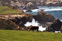
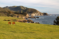
It was an unnamed and unmarked turnout right after Rocky Point. As we looked down the coast, we saw a small herd of Hereford cattle standing in a pasture.
Just off the coast was an arch. When the waves crashed against the shore, they funneled out through the arch. The scene had a pastoral feel,
but it also included gorgeous coastal scenery. The cows in the pasture had no idea of the beauty around them. They were content to spend the day
eating with the waves crashing behind them. We named the location Cow Arch
We bypassed Pt. Lobos State Reserve and
continued south. We would explore Pt. Lobos later on the trip. We made several minor stops in the Lobos Rocks area before we reached our favorite location.
It was an unnamed and unmarked turnout right after Rocky Point. As we looked down the coast, we saw a small herd of Hereford cattle standing in a pasture.
Just off the coast was an arch. When the waves crashed against the shore, they funneled out through the arch. The scene had a pastoral feel,
but it also included gorgeous coastal scenery. The cows in the pasture had no idea of the beauty around them. They were content to spend the day
eating with the waves crashing behind them. We named the location Cow Arch![]() after the starring role
the Herefords played in the scene.
after the starring role
the Herefords played in the scene.
We stopped at the Castle Rock and Bixby Bridge overlooks, but the next major overlook was Hurricane
Point.![]() It's name was well-chosen
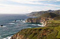
for today. The wind was blowing directly off the ocean, and it was cold. Hurricane Point provides the view looking north at Bixby Bridge
and the rocky coast that is shown in so many commercials and magazines. The view south is only slightly less impressive.
It's name was well-chosen
for today. The wind was blowing directly off the ocean, and it was cold. Hurricane Point provides the view looking north at Bixby Bridge
and the rocky coast that is shown in so many commercials and magazines. The view south is only slightly less impressive.
As we approached Big Sur, we realized how many people were enjoying a beautiful Sunday afternoon drive along the coast. Every tourist area was packed with people and cars. We couldn't even get in to see Arch Rock. The parking lot was already filled, and they were turning everyone away.
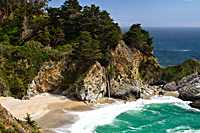
Our final stop was McWay Falls![]() in Julia Pfeiffer
Burns State Park. It is one of only two waterfalls on the West Coast that drops directly into the ocean. The other is farther north and requires
an 8-mile hike. We were much more interested in the 1/2 mile stroll to McWay Falls. Although the sky was hazy and it was mid-afternoon,
it was still a very cool place.
in Julia Pfeiffer
Burns State Park. It is one of only two waterfalls on the West Coast that drops directly into the ocean. The other is farther north and requires
an 8-mile hike. We were much more interested in the 1/2 mile stroll to McWay Falls. Although the sky was hazy and it was mid-afternoon,
it was still a very cool place.
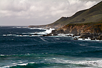
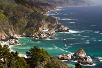
When we finished shooting at McWay Falls, we still had a couple hours before sunset. We decided to drive back to Garrapata
Beach![]() , which
we mad missed as we drove south. The traffic was much lighter now, and we didn't think we would have any problem turning around to park along the highway.
We hiked along the cliffs above the beach to view the rocky shore to the north. We had the whole area to ourselves.
, which
we mad missed as we drove south. The traffic was much lighter now, and we didn't think we would have any problem turning around to park along the highway.
We hiked along the cliffs above the beach to view the rocky shore to the north. We had the whole area to ourselves.
We spent the next couple of hours between Cow Arch and Hurricane Point as we photographed the changing light. Cow Arch was our final sunset location, but the fog thickened and the clouds rolled in before the sun reached the horizon. We got some golden light at Cow Arch, but there was no sunset tonight.
It was late by the time we returned to camp. We downloaded all the images, made a quick dinner, did the backups, and went to bed. We didn't even have the energy to look at our images.
Big Sur Gallery
 |
 |
 |
| Garrapata Beach | Cow Arch | Hurricane Point | 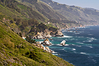 |
 |
 |
| Hurricane Point | McWay Cove | McWay Falls |

