GPS Chaos
Our plan was to drive over to the BLM office and get road conditions and general information about the back roads that lead to the badlands we want to photograph. To our surprise, the BLM office was closed. It seems they are less involved with tourism and more involved with the oil drilling that surrounds Farmington.
We returned to camp for lunch and tried to decide what to do next. Since it was a weekend, we weren't going to get any information until Monday. We finally decided to drive to the Bisti Wilderness to get an idea of where the parking lots were, the orientation of the main washes, and a general feel for the area. It was over 30 miles each way, but at least we'd find the turnoffs and parking areas.
All our routes were carefully planned and entered into our GPS, so we expected no problems finding the parking areas and roads. Driving from Farmington to the general area of the Bisti Wilderness was no problem, but the GPS was WILDLY inaccurate when it came to the dirt roads that provided access to the wilderness. The GPS had roads were there were none and was missing the roads we needed. We eventually learned that the northern parking lot was completely blocked off (and that's the one we wanted to use tomorrow). There was a sign marking a gravel road to a second parking lot, but according to the GPS, it was in the wrong place. After driving up and down the highway, we figured out that there is now only one gravel road that accesses the Bisti Wilderness. Access to all the formations in the northern wash now have the added miles of coming from the southern parking lot.
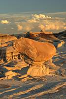
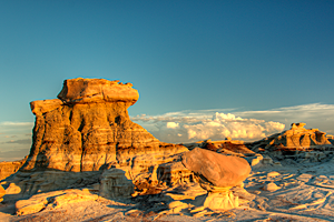
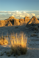
It was too late to start a hike into the Bisti Wilderness, so we decided to stop at an interesting area we had passed along the main highway to Bisti. It didn't look like anything special, but it would give us a taste of what we'll see at Bisti. We found the tracks of a mountain lion who passed through the area, some very interesting petrified wood, and a few hoodoos. In the golden light, the hoodoos radiated a warm, soft glow.

|

|

|

