Today, we spent the whole day in Yosemite Valley. It was a gorgeous summer day and seemed more like July than May.
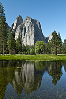
Our first stop was a low area of Sentinel Meadows![]() that floods nearly every spring to provide wonderful reflections of Cathedral Rocks. Although there is
much less water this year, there was enough to create a good reflection.
that floods nearly every spring to provide wonderful reflections of Cathedral Rocks. Although there is
much less water this year, there was enough to create a good reflection.
We continued our tour of the Cathedral Rocks area by shooting from the bridge that links Northside and Southside Drives. On the side of the road, sat a man who was part of a park program to educate visitors about the climbers who scale El Capitan. He had posters of the routes up this monolith, as well as a spotting scope set up to see the climbers. However, the most interesting thing was the 6-pack fishing. Someone had already "caught" two 6 packs of beer and had them tied to the railing of the bridge to keep them from escaping down river.
One of the classic spring images in Yosemite Valley is a shot of dogwood flowers over the Merced River. The peak of the dogwood trees
has already passed in the Valley and is now up around the 6000 foot level surrounding the Valley. We managed to find one dogwood tree
in full bloom beside the
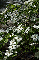
Pohono Bridge.![]() The tree had good lighting and the leaves were a brilliant green. The only thing missing were rapids below
the flowers that could be slowed with a slow shutter speed to create a soft white background.
Our tree's claim to fame were masses of flowers in tightly bunched clusters.
We may not have found the classic shot, but we will have some very nice dogwood shots to bring home.
The tree had good lighting and the leaves were a brilliant green. The only thing missing were rapids below
the flowers that could be slowed with a slow shutter speed to create a soft white background.
Our tree's claim to fame were masses of flowers in tightly bunched clusters.
We may not have found the classic shot, but we will have some very nice dogwood shots to bring home.
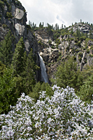
Wildcat Falls![]() was our next stop. It is off the El Portal road and has managed to elude our photography for the past 39 years.
The falls is hidden in a small alcove with trees blocking views of the lower half of the falls. A white ceanothus
right next to the parking area provided a great foreground and contrast to the green trees surrounding the falls.
was our next stop. It is off the El Portal road and has managed to elude our photography for the past 39 years.
The falls is hidden in a small alcove with trees blocking views of the lower half of the falls. A white ceanothus
right next to the parking area provided a great foreground and contrast to the green trees surrounding the falls.
|
|
 |
| Sentinel Rocks | Dogwoods | Wildcat Falls |
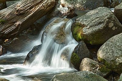
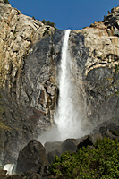
Most of the rest of the afternoon was spent shooting in the Bridalveil Falls![]() area. We parked on Southside Drive so we could shoot Ribbon Falls before it dried up. Our next focus was on Bridalveil Creek just below the falls.
The sun was far enough to the west and low enough to provide good lighting as the stream cascaded down the forested hillside.
There were waterfalls and cascades of all sizes just waiting for someone to isolate them with a long lens and make them famous.
area. We parked on Southside Drive so we could shoot Ribbon Falls before it dried up. Our next focus was on Bridalveil Creek just below the falls.
The sun was far enough to the west and low enough to provide good lighting as the stream cascaded down the forested hillside.
There were waterfalls and cascades of all sizes just waiting for someone to isolate them with a long lens and make them famous.
Bridalveil Creek began to bend away from the trail as we neared the falls. We returned to the trail and hiked up to the main viewing point. Normally in the spring, we would be soaked in a couple minutes standing at this point. Today, there was only enough mist to raise a concern about water spots on our lenses. We protected our lenses the best we could and quickly shot Bridalveil Falls.
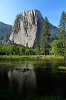
El Capitan![]() mirrored in the Merced River was our next stop. We continued on Southside Drive to the turnout and short photographer's
trail down to the Merced River. In early spring, the Merced is nearly twice its normal width and provides a deep green
foreground in front of the meadow, black oaks, and the towering west face of El Capitan. We've frequently photographed
from this spot in the snow, which makes the spring green in the meadows and trees seem even brighter and more saturated.
mirrored in the Merced River was our next stop. We continued on Southside Drive to the turnout and short photographer's
trail down to the Merced River. In early spring, the Merced is nearly twice its normal width and provides a deep green
foreground in front of the meadow, black oaks, and the towering west face of El Capitan. We've frequently photographed
from this spot in the snow, which makes the spring green in the meadows and trees seem even brighter and more saturated.
|
 |
| Bridalveil Falls | El Capitan |


